Community-based planning for a walkable and healthy environment
Local Walkability Plans connect communities, schools and municipalities to make walking safer, healthier and easier for everyday life

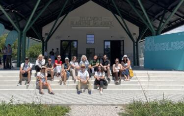
Photo: Jana Okoren
IPoP – Institute for Spatial Policies and CIPRA Slovenia are developing an approach to designing walkable environments through the Active to School and Healthy City programme as part of efforts to promote children’s health and well-being.
Our initiative began by collaborating with educational institutions and local governments to assess the conditions for walking and cycling on school routes. We subsequently expanded our study to encompass the broader local area. The principal characteristic of this approach is an inclusive process that brings together a diverse group of participants and facilitates two-way communication.
It informs about the planning process and serves to broaden understanding and motivation for walking. The result is a Local Walkability Plan that links physical and infrastructural measures with organizational and awareness-raising actions, thereby influencing local community action in recommended areas. The planning process and methods were developed and tested over four years in collaboration with representatives of selected Slovenian municipalities and spatial planners.
Our work is based on the evidence presented in studies on health, environmental, and societal benefits of walking, as well as the recommendations set forth by the World Health Organization (WHO) for a community-based and cross-sectoral approach to ensuring public health and healthy living environments. Our experience has demonstrated that the most effective way to improve walking conditions is through the combined action of actors from different sectors and the involvement of the local community.
Background
Our work towards more walkable environments in Slovenia has started through our effort for active travel to school. We were encouraged by the data that showed that the number of children walking and cycling to school in Slovenia has halved in the last 30 years, and that sedentary lifestyles have a critical impact on the health of children and young people. We have drawn on the World Health Organisation’s (WHO) warnings that sedentary lifestyles are the leading cause of death from a range of diseases and disabilities. Furthermore, we have considered the findings that active mobility can be the most affordable, accessible and simple solution for countries and local communities to reduce these health problems.
It was determined that school routes in Slovenia, which boast a relatively dense network of primary schools (450 primary schools, 311 branches), represents a promising starting point for increasing children’s physical activity. Further engagement with pupils and schools facilitated the formation of connections with municipalities and local communities, enabling the extension of our actions from school routes to wider study areas.
We put an interdisciplinary working group and methods at the heart of the planning process with the aim to contribute to the quality of walking conditions in the local environment through the development of a Local Walkability Plan, capturing the experiences and needs of (public space) users.
Through the process and the planning approach we combined the creation of walkable spaces with efforts to connect local actors with (public space) users to create a living environment that supports health and well-being as well as encourages physical activity. The concept of a health- and well-being-friendly environment has been defined as a physical and social environment in which a cohesive community of local actors systematically plan and create conditions for walking and cycling.
Our approach to planning is also founded upon the principles of participation and integration of actors in spatial planning processes. Additionally, it is based on understanding of walking as a transportation mode that:
- is the most natural, inclusive, democratic, simple and inexpensive approach,
- makes a significant contribution to individual’s health and well-being, as well as to strengthening of social cohesion and inclusion,
- does not have a negative impact on the environment,
- is spatially and infrastructurally undemanding,
- provides significant economic impacts.
The evidence suggests that by substituting short-distance car journeys (less than 2 kilometers) with walking or cycling, an immediate reduction in greenhouse gas emissions and noise pollution in the local environment can be achieved. Furthermore, this shift in transportation can lead to a reduction in travel costs and an increase in interest in the range of activities and services available in the local area.

The walkable environment as a measure of a healthy living environment
In response to the findings regarding the population’s critical state of health in the 20th century, the World Health Organization (WHO) launched the Healthy Cities Programme. The WHO has recently emphasized the significance of spatial planning and urban design for health. The fundamental premise of the Healthy Cities programme is that connected local communities are more effective in establishing the conditions for healthy living and supporting society in addressing future health challenges. This prompted our interest, as we recognised that when planning active walking to school, the primary determinants of children’s mode of travel to school are adults’ and caregivers’ perception of safety, the driving culture and traffic management.
Consequently, the school travel planning process has already been conceptualized in an inclusive manner when working with educational institutions. The planning process involved children, caregivers, the Council for Road Traffic Prevention and Education, school management and staff, and the municipality. This approach facilitated a more comprehensive exploration of the topic of safety and the journey to school, encompassing a broader context, content, and resonance than is typically observed. During the process of developing a Local Walkability Plan, methods for involving the relevant actors and the local community were further refined to align with the principles of community-based management of high-quality walking conditions.
The design of a Local Walkability Plan is an opportunity to simultaneously develop knowledge and skills. By organizing work and involving people in the process, we can gain insights into designing a walkable environment and learn how to collaborate effectively to create a well-designed space for walking that also supports the well-being and health of all users.
Local Walkability Plan
A Local Walkability Plan is not a traditional spatial plan. Rather, it is a set of infrastructure, organizational and awareness-raising measures that can be used in a targeted way by the local community to improve walking conditions in spatial, transport and various other activities, as well as in the management and use of space. The organization of a working group and the working process ensures that the plan has an impact on a wide range of actors and activities.
When developing solutions, we considered the national Department for Infrastructure’s expert guidelines for the preparation of the Integrated Transport Strategy and the guidelines for pedestrian infrastructure. Furthermore, we have taken into account the walkability assessment tools and recommendations of Cities Alive, as well as the experience of the CityWalk project, which produced a Walkability Strategy for the City of Kamnik with a Local Walkability Plan.
The most important component of the plan is the assessment of walking conditions in the area. The assessment is carried out with an alert list method, which facilitates a comprehensive examination of the area and directs the analysis of the walking experience and requirements of diverse groups of local inhabitants.
The primary planning tool is the assessment of walking distances. The calculated walking distances of 5, 10, and 15 minutes, verified through spatial analysis in the examined areas, based on the walking speeds of children and adults, indicate the potential for walking as a time-efficient mode of transportation and for accessing activities and programmes in terms of time use and accessibility. The premise that the length of a walking route should be short enough to not dissuade the user from embarking on the journey has been adopted as a basis for analysis.
In the context of accessibility to parks, playgrounds and green spaces, the World Health Organization (WHO) has established a distance of 300 meters as the recommended threshold. To complete daily routines and errands by walking, the 400-meter criterion is well established and considered to be the distance over which walking can be done faster and more practical than if it were done by car. When preparing the Local Walkability Plan, walking distances were calibrated to a walking speed of 3.6 km/h, which has been repeatedly verified to be 300 meters in 5 minutes for the average adult user. However, in the case of younger children, caregivers with young children and dynamic terrain, a correspondingly lower walking speed has been taken into account, and the indoor walking distances have been adjusted accordingly.

In the course of developing the walkability plans, we conducted interviews and organized walks with residents and local stakeholders from a range of groups in order to gather further qualitative data that could be used to verify the walkability of the local environment. We gathered a number of significant findings on local walking conditions from children, individuals with physical and sensory disabilities, and older pedestrians. The data and information gathered assisted participants involved in the planning process to develop a more comprehensive understanding on the safety and other walking conditions from the perspective of different participants, the realistic expectations of people walking more, and other related topics. We have learned from these discussions that in order for children to walk to school safely and independently, it is necessary to moderate traffic speeds, remove short-term parking of vehicles from public spaces, encourage drivers to be more tolerant of pedestrians, adapt traffic management such as traffic light intervals and roundabouts to the abilities and needs of young pedestrians, and ensure that pedestrian routes are clearly marked through parking areas and when crossing cycle paths.
Experience with the first Local Walkability Plans has shown that the design approach and solutions need to be tailored to the situation and local specificities. Adapting the organization and implementation of the planning process and the analytical tools to the circumstances and needs became the main thread of the planning process and a key guideline for the preparation of Local Walkability Plans.
Community-based planning process
The process of developing a Local Walkability Plan follows a predefined organization and workflow, but the implementation of individual tasks and methods is adapted to the needs and characteristics of the local environment. In particular, involvement of the community in the planning process during pilot testing was adapted to the epidemiological situation, the characteristics of the settlements and the willingness of the community to test the actions.
The process consists of four phases: preparation, situation analysis, formulation of measures and development of an action plan. Representatives of the local community are involved in all phases, ensuring that the plan not only meets real needs, but also has a long-term impact on the public opinion and community attitudes towards walking.
As a first step, a municipal working group is set up to coordinate work at municipal level, to ensure that walking and active mobility are integrated into all relevant areas of work, and to provide cross-sectoral and political support for the promotion of good walking conditions. As transport planning often does not involve sectors such as education, health, etc., the group ensures that stakeholders are brought together and encourages cooperation for better walking conditions.
Preparatory work includes a review of municipal documents and the preparation of mapping documents covering schools, school catchment areas, public transport stations and social infrastructure facilities. Isochronic displays of walking distances are used as an analytical and awareness-raising tool to facilitate the understanding of walking distances and accessibility.
The focus group involves a wider range of local stakeholders, such as representatives from public institutions in the fields of health, education, culture, social and educational services, road safety and civil society organizations working with youth, the elderly and special population groups, as well as representatives from the regional unit of the National Institute of Public Health, local tourism organizations and major employers. They provide an early insight into the situation and needs of the local community and help to identify the areas to be addressed by the Local Walkability Plan. The group contributes to the analysis, formulation of solutions and evaluation of the action plan.
Residents are involved in the process of analyzing the situation, designing and evaluating the measures in a variety of ways, massively through online surveys and public debates, but also as representatives of specific groups such as major employers, schoolchildren, the elderly and people with disabilities, through walks and interviews. Furthermore, surveys are conducted with schoolchildren to ascertain their preferred mode of travel to school and their typical travel habits. Similarly, surveys are carried out with school staff to gain insight into their travel patterns.
Walkshop with children. Photo by Jana Okoren

Situation analysis
The situation analysis is carried out through a combination of study and fieldwork, as well as the involvement of local residents. We use a checklist to monitor the quality of walking surfaces, road, rail and cycle crossings, urban amenities, safety, neighborhood amenities, access to local services, shelter from sun and rain, general accessibility of spaces, facilities and information, conditions for cycling and public transport. The analysis also includes data on the health of the local population and existing development documents (transport strategies, school travel plans, parking policies).
A key aspect for understanding a place’s characteristics are walking distances. Typically, walking distances serve as a criterion for delineating the area of consideration. In general, walking distances are also a criterion in defining the area of consideration. A Local Walkability Plan can be developed for any arbitrary-sized area. Alternatively, the area of consideration can be an area where activities are concentrated or where significant issues are perceived.
In the Active Travel to Schools and Healthy City programme, primary schools were most often selected as the focal point of the considered area. However, isochrones have also been employed to examine walking distances from the municipality or the main bus station, with the objective to include otherwise sensible areas. The collaboration with schools has facilitated the assessment of the walking distance of pupils’ homes from school, which provided a solid foundation for realistic discussions on children’s opportunities to actively walk to school.

Conclusions and discussion
The Local Walkability Plan encompasses a range of measures, including infrastructure, organizational and awareness-raising measures, all of which contribute to improving the walkability of a given area. Infrastructure measures focus on improving pedestrian areas, repairing damaged footpaths, modifying traffic signals, removing obstructions on footpaths, providing sufficient greenery and regular and seasonal maintenance, traffic calming, and so on. The most important among the organizational measures is the recommendation for a more integrated work of the municipal professional services through the creation of a permanent municipal working group on walking and public space. The aim of awareness-raising activities is to increase understanding of the importance of walking for health, the environment and quality of life, as well as for achieving sustainable development goals. Municipalities can achieve this by implementing campaigns and activities such as the Walking Bus, the School Street, the demarcation of walking routes and the integration of walking into tourism offers, which encourage walking and contribute to the creation of a positive social climate and improved walking conditions.


Map of proposed infrastructure measures. Map by Urška Didovič (left). One of the results of this process is an updated school route map that can include Kiss and Ride spots and Walking Bus stops. Map by Urška Didovič (right).
When planning spaces for walking and encouraging people to walk for their daily activities, we consider both the quality of walking surfaces and pedestrian safety in traffic, as well as the destinations that users can achieve with short-distance walking. The objective of the design is to make walking the most logical and practical choice. Our considerations extend to the structural development of urban areas, incorporating the imperative for ambitious mixed-use planning and strategic relocation of social and central activities in closer proximity to residential areas. These concepts align with the evolving paradigms of modern urban development, which are shaped by a multifaceted set of considerations, including environmental protection, nature conservation, and the pursuit of long-term sustainable and equitable living.
A walkable environment may therefore be defined as a space where the local community engages in systematic and organized efforts to establish optimal conditions for walking and to promote walking through various initiatives.
The Active to School and Healthy City program is coordinated by IPoP – Institute for Spatial Policies, in collaboration with CIPRA Slovenia, the Association for the Protection of the Alps. The program is supported by the Ministry of Health of the Republic of Slovenia and is part of the National Program “Dober tek, Slovenia,” which promotes more physical activity and healthier eating.
Written by Maja Simoneti, Jana Okoren, Urška Didovič